Highland
§ This page gives an overview of the Highland local authority district, bringing together key facts, maps, and data to help you quickly understand the area. This is one of 361 LAD profiles on Baseview.
Overview ⁞ Highland is Scotland’s largest council area by land, covering vast mountain ranges, lochs, and coastal landscapes. Tourism, renewable energy, and agriculture dominate the economy. Inverness is the main city and a gateway to the Highlands.
Highland Boundary Map
This map shows the official boundary of the Highland local authority district, based on the latest geographic data published by the Office for National Statistics (ONS). It provides a clear view of the district’s extent and helps you understand how the area fits within the wider regional and national landscape.
Contains OS data © Crown copyright and database right 2025. Source: Office for National Statistics licensed under the Open Government Licence v3.0.
The administrative boundary of Highland can also be viewed on OpenStreetMap: District Boundary of Highland.
Key Facts about Highland
What region is Highland in? Highland is in Scotland, a statistical region and also a country in United Kingdom.
Is Highland a city? Yes, Highland is a city. Highland holds official city status as one of the 76 designated cities in the UK.
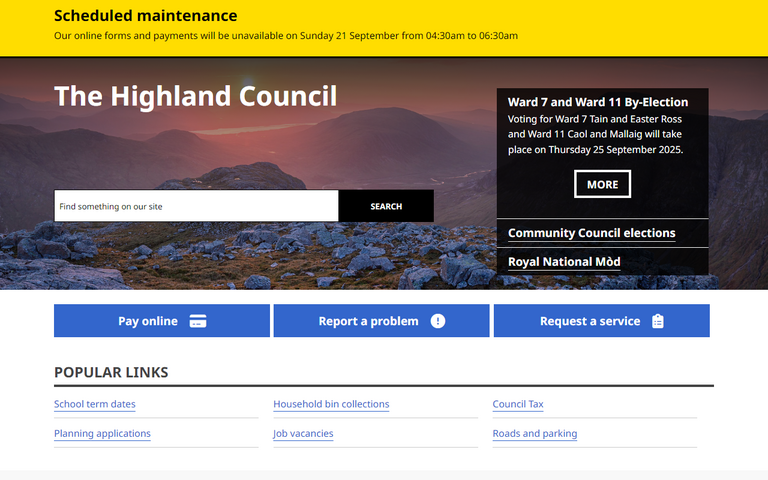
Who governs Highland? The local government for this district is: The Highland Council (Scotland Council Area).
▶ Official website of The Highland Council 🔗 highland.gov.uk
Which police force covers Highland? Policing in Highland is provided by Police Scotland 🔗 scotland.police.uk, which covers the whole of Scotland.
Highland in International Geographies
In the International Territorial Levels (ITLs) hierarchy, Highland is within an ITLs Level 3 area:
- (ITL 1) Scotland
- (ITL 2) ⇒ Highlands and Islands
- (ITL 3) ⇒⇒ Highlands and Islands
The International Territorial Levels are used by OECD member countries for statistical purposes to classify administrative areas. We have this listable page for easy browsing of ITL names and codes: International Territorial Levels.
Constituencies in Highland
Highland is divided into 4 parliamentary constituencies, listed below in alphabetical order.
- Argyll, Bute and South Lochaber
- Caithness, Sutherland and Easter Ross
- Inverness, Skye and West Ross-shire
- Moray West, Nairn and Strathspey
A constituency is a specific geographical area that elects one Member of Parliament (MP) to represent them in the House of Commons. The United Kingdom is divided into 650 parliamentary constituencies, 57 of them are in Scotland. We have this list page for easy browsing of all UK parliamentary constituencies: List of Constituencies.
Wards in Highland
Highland is divided into 21 wards, listed below in alphabetical order.
- Aird and Loch Ness
- Badenoch and Strathspey
- Black Isle
- Caol and Mallaig
- Cromarty Firth
- Culloden and Ardersier
- Dingwall and Seaforth
- East Sutherland and Edderton
- Eilean á Chèo
- Fort William and Ardnamurchan
- Inverness Central
- Inverness Millburn
- Inverness Ness-side
- Inverness South
- Inverness West
- Nairn and Cawdor
- North, West and Central Sutherland
- Tain and Easter Ross
- Thurso and Northwest Caithness
- Wester Ross, Strathpeffer and Lochalsh
- Wick and East Caithness
In the UK, a ward is a subdivision of a local authority area, used mainly for electoral and statistical purposes. Defined by the ONS, wards represent the primary unit for local elections, each returning one or more councillors to the local council. Wards are also used as a key geography for presenting population and census data. We have this list page for easy browsing of all electoral wards: List of all Electoral Wards in the UK.
Post Towns in Highland
Below is a list of post towns in Highland, grouped by postcode area:
- IV ▸ Achnasheen (IV22) ⁞ Alness (IV17) ⁞ Ardgay (IV24) ⁞ Avoch (IV9) ⁞ Beauly (IV4) ⁞ Cromarty (IV11) ⁞ Dingwall (IV7 / IV15 / IV16) ⁞ Dornoch (IV25) ⁞ Fortrose (IV10) ⁞ Gairloch (IV21) ⁞ Garve (IV23) ⁞ Invergordon (IV18) ⁞ Inverness (IV1 / IV2 / IV3 / IV5 / IV13 / IV63 / IV99) ⁞ Isle of Skye (IV41 / IV42 / IV43 / IV44 / IV45 / IV46 / IV47 / IV48 / IV49 / IV55 / IV56) ⁞ Kyle (IV40) ⁞ Lairg (IV27) ⁞ Muir of Ord (IV6) ⁞ Munlochy (IV8) ⁞ Nairn (IV12) ⁞ Plockton (IV52) ⁞ Portree (IV51) ⁞ Rogart (IV28) ⁞ Strathcarron (IV54) ⁞ Strathpeffer (IV14) ⁞ Strome Ferry (IV53) ⁞ Tain (IV19 / IV20) ⁞ Ullapool (IV26)
- KW ▸ Berriedale (KW7) ⁞ Brora (KW9) ⁞ Dunbeath (KW6) ⁞ Forsinard (KW13) ⁞ Golspie (KW10) ⁞ Halkirk (KW12) ⁞ Helmsdale (KW8) ⁞ Kinbrace (KW11) ⁞ Latheron (KW5) ⁞ Lybster (KW2 / KW3) ⁞ Thurso (KW14) ⁞ Wick (KW1)
- PH ▸ Acharacle (PH36) ⁞ Arisaig (PH39) ⁞ Aviemore (PH22) ⁞ Ballachulish (PH49) ⁞ Boat of Garten (PH24) ⁞ Carrbridge (PH23) ⁞ Corrour (PH30) ⁞ Dalwhinnie (PH19) ⁞ Fort Augustus (PH32) ⁞ Fort William (PH33) ⁞ Glenfinnan (PH37) ⁞ Grantown-on-Spey (PH26) ⁞ Invergarry (PH35) ⁞ Isle of Canna (PH44) ⁞ Isle of Eigg (PH42) ⁞ Isle of Rum (PH43) ⁞ Kingussie (PH21) ⁞ Kinlochleven (PH50) ⁞ Lochailort (PH38) ⁞ Mallaig (PH40 / PH41) ⁞ Nethy Bridge (PH25) ⁞ Newtonmore (PH20) ⁞ Roy Bridge (PH31) ⁞ Spean Bridge (PH34)
The UK postal hierarchy begins with broad postcode areas (such as “CB” or “M”), which are divided into smaller postcode districts (such as “CB8” or “M1”) to support accurate mail routing. Each postal address is anchored by a designated post town, the official locality name used in the UK postcode system, which operates independently from Local Authority Districts —the administrative boundaries used for council tax and local government services. Because they serve different purposes, a property’s postal address and its local authority district do not always align exactly.
Built-up Areas in Highland
Highland covers 85 built-up areas, listed below in alphabetical order.
- Achduchil
- Alness
- Ardersier
- Arisaig
- Auldearn
- Aultbea
- Aviemore
- Avoch
- Balintore
- Ballachulish
- Beauly
- Boat of Garten
- Bonar Bridge
- Breakish
- Broadford
- Brora
- Buldoo
- Cannich
- Caol
- Carrbridge
- Castletown
- Conon Bridge
- Contin
- Corpach
- Cradlehall
- Cromarty
- Croy (Highland)
- Culbokie
- Dingwall
- Dornoch
- Drumnadrochit
- Dunnet
- Duror
- East Helmsdale
- Embo
- Evanton
- Fendom
- Fort Augustus
- Fort William
- Fortrose
- Gairloch
- Glencoe
- Glenfinnan
- Golspie
- Grantown-on-Spey
- Halkirk
- Hardmuir
- Invergordon
- Inverness
- Isleornsay
- Kiltarlity
- Kincraig
- Kingussie
- Kinlochmore
- Kirkhill
- Kyle of Lochalsh
- Lairg
- Lochcarron
- Lochyside
- Lower Breakish
- Mallaig
- Maryburgh
- Muir of Ord
- Munlochy
- Nairn
- Nethy Bridge
- Newlands of Culloden
- Newtonmore
- Nigg Ferry
- North Ballachulish
- North Kessock
- Portmahomack
- Portree
- Portskerra
- Rosemarkie
- Roybridge
- Scrabster
- Spean Bridge
- Strathpeffer
- Strontian
- Tain
- Thurso
- Ullapool
- Watten
- Wick (Highland)
In the UK, a Built-up Area (BUA) is a continuous urban area of at least 20 hectares (0.2 km²), defined by the ONS as land where buildings are generally no more than 200 metres apart, such as towns, cities, or large villages. (Note: A BUA name marked with an asterisk (*) indicates that the area is situated partly in the district of Highland.)
We have this list page for easy browsing of all built-up areas: List of all Built-up Areas in GB.
Railway Stations in Highland
Highland is served by a number of National Rail stations, providing rail connections to nearby towns, cities, and destinations across Great Britain. The railway stations listed below are located within the Highland Local Authority District and are grouped by train operating company for clarity.
- ScotRail ▸ Inverness (IV2 3PY) ⁞ Fort William (PH33 6TQ) ⁞ Nairn (IV12 4QS) ⁞ Aviemore (PH22 1PD) ⁞ Mallaig (PH41 4QA) ⁞ Dingwall (IV15 9PZ) ⁞ Inverness Airport (IV2 3PY) ⁞ Kyle Of Lochalsh (IV40 8AH) ⁞ Muir Of Ord (IV6 7ST) ⁞ Kingussie (PH21 1EN) ⁞ Thurso (KW14 7DL) ⁞ Beauly (IV4 7EF) ⁞ Invergordon (IV18 0RY) ⁞ Tain (IV19 1JA) ⁞ Corrour (PH30 4AA) ⁞ Alness (IV17 0SE) ⁞ Glenfinnan (PH37 4LS) ⁞ Wick (KW1 4QT) ⁞ Conon Bridge (IV7 8AA) ⁞ Plockton (IV52 8TX) ⁞ Newtonmore (PH20 1AL) ⁞ Spean Bridge (PH34 4EP) ⁞ Carrbridge (PH23 3AJ) ⁞ Banavie (PH33 7JF) ⁞ Strathcarron (IV54 8YR) ⁞ Brora (KW9 6PY) ⁞ Ardgay (IV24 3AQ) ⁞ Arisaig (PH39 4NJ) ⁞ Golspie (KW10 6SZ) ⁞ Loch Eil Outward Bound (PH33 7NN) ⁞ Morar (PH40 4PB) ⁞ Helmsdale (KW8 6HH) ⁞ Lairg (IV27 4EX) ⁞ Garve (IV23 2QF) ⁞ Fearn (IV20 1RS) ⁞ Corpach (PH33 7LS) ⁞ Dalwhinnie (PH19 1AD) ⁞ Achnasheen (IV22 2EJ) ⁞ Roy Bridge (PH31 4AH) ⁞ Lochailort (PH38 4LZ) ⁞ Tulloch (PH31 4AR) ⁞ Georgemas Junction (KW12 6HH) ⁞ Forsinard (KW13 6YT) ⁞ Dunrobin Castle (KW10 6SF) ⁞ Stromeferry (IV53 8UH) ⁞ Rogart (IV28 3XL) ⁞ Attadale (IV54 8YX) ⁞ Duirinish (IV40 8BD) ⁞ Achnashellach (IV54 8YH) ⁞ Achanalt (IV23 2QD) ⁞ Locheilside (PH33 7PN) ⁞ Lochluichart (IV23 2PZ) ⁞ Kinbrace (KW11 6UB) ⁞ Invershin (IV27 4ET) ⁞ Duncraig (IV52 8TZ) ⁞ Culrain (IV27 4ET) ⁞ Kildonan (KW8 6HY) ⁞ Beasdale (PH39 4NR) ⁞ Scotscalder (KW12 6YH) ⁞ Altnabreac (KW12 6UR)
This is a district-level view only. For a complete list of all National Rail stations across Great Britain, see the UK National Rail Stations Directory.
Latest news about Highland
Use the search box, or suggested search phrases, below to find recent news, council updates, planning stories, housing developments, transport changes, public services news, local elections, community issues and other local developments related to Highland. Results may include coverage from UK national, regional and local news websites, as well as official public-sector and local democracy sources.
- Highland council
- Highland planning
- Highland local elections
- Highland housing
- Highland transport
- Highland regeneration
- Highland public services