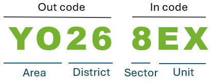
Postcode districts — commonly known as outcodes — form the middle level of the UK postcode system. Each outcode (such as AB10, DN22, or SW1) represents a subdivision within a postcode area and typically covers multiple neighbourhoods, wards, or administrative zones.
The UK Postcode Format and Components
This page lists all UK postcode districts (around 2,945 outcodes) and shows how each one is distributed across local authority districts and wards. Alongside postcode counts (PC #), you can see how widely an outcode spreads geographically, making this page useful for understanding postcode structure, administrative overlap, and local coverage patterns.
Select a postcode area :
to filter the data table below.
Comprehensive list of UK postcode districts including postcode unit counts, local authority distribution, and electoral ward coverage.
Code
PC #
Post Town
Local Authority Districts
D#
Wards Covered
W#
Area
Code
PC #
Post Town
Local Authority Districts
D#
Wards Covered
W#
Area
Note: for each postcode district, the corresponding post town is shown for reference. Information on postcode outcodes and post towns is derived from a downloadable dataset provided by Geoapify. Post towns are a key component of UK postal addressing, but they are defined for routing purposes and may not always reflect local administrative or commonly used place names. For authoritative and postcode-specific results, users should refer to Royal Mail’s official Postcode Finder.
This page focuses on postcode districts. Depending on your needs, you may also find these related resources useful:
A page dedicated to postcode areas, where postcode areas are the main subject and their distributions are explored.
A comprehensive postcode lookup page listing all individual postcode units, mapped to their ward, district, county, and country.
Together, these pages allow you to explore the UK postcode system at area, district, and unit level, depending on the depth of analysis you require.
Our tools about UK postcodes were based on OS Postcodes Data (Version Date: November 2025). The program that generated this web page was last updated on . The total numbers of postcodes shown in each postcode district are snapshot based on the dataset processed at the time of generation. Postcode counts may change over time due to new postcode creation, withdrawal, or boundary adjustments, and should be used for comparative and reference purposes only.